Live AIS & NMEA view
Connect over Wi-Fi to a pilot plug, AIS receiver, NMEA TCP server or smart pilot plug device and view key movement values clearly.
A clean professional viewer for AIS, NMEA and docking data - made for maritime pilots, captains and bridge officers who need live vessel movement information where it matters.
Pilot Plug helps show live vessel movement on a mobile Android device - on the bridge, on the bridge wing, during tests, training, monitoring and operational awareness.
Connect over Wi-Fi to a pilot plug, AIS receiver, NMEA TCP server or smart pilot plug device and view key movement values clearly.
Course over ground, speed over ground, heading and rate of turn - laid out with large values for quick interpretation under load.
Ship-silhouette view using standard maritime color coding - red port, green starboard - with bow, midship and aft movement information when available.
Docking Mode B (long press) uses a KA motion model to project heading and motion trends ahead - the same approach used by klaipedatraffic.lt for vessel forecasting.
Choose AIS and NMEA sources independently for position and heading - useful when one feed is more reliable than the other for a given value.
Ship dimensions populate automatically from AIS Type 5 static reports as vessels appear in the stream - less manual setup before pilotage.
Freeze the live NMEA position values with one tap to capture a precise position entry for logbook or report use - without losing the live feed.
High-contrast dark UI with blue accents, large numbers and minimal distraction - designed to read well in real bridge lighting conditions.
Presets for common TCP data sources, or enter your own host and port for onboard testing and professional setups.
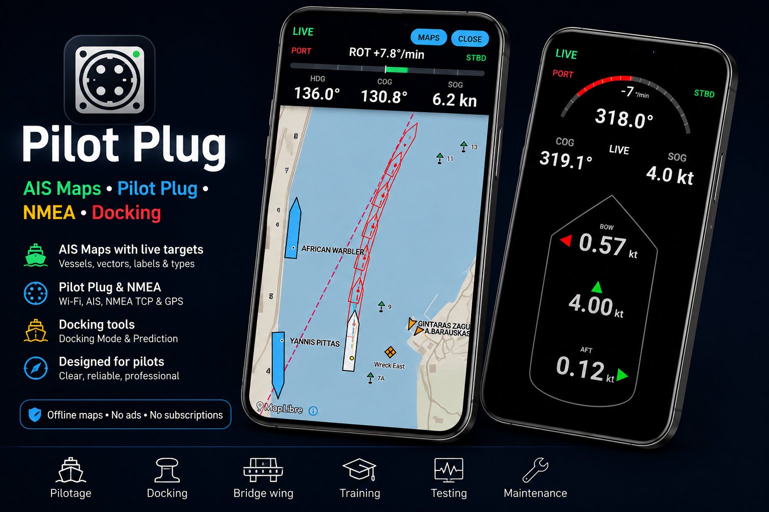
AIS Map Mode displays external AIS targets on an offline map, helping pilots and bridge officers understand nearby vessel movement without relying on a continuous internet connection.
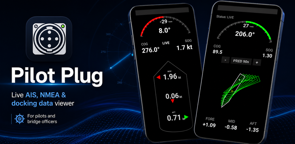
Docking Mode focuses on the information that matters during close-quarters movement: how the ship is moving now, how the bow and stern are behaving, and how the trend may develop shortly ahead.
Pilot Plug maneuvering prediction was compared onboard against the vessel’s installed professional bridge navigation equipment during a dynamic low-speed maneuver. The vessel was moving at approximately 1–2 kn, with rate of turn reaching approximately 30°/min, substantial transverse movement, and rapidly changing heading and course over ground.


During close-quarters maneuvering, the bow and stern can have very different velocities. Pilot Plug does not simply rotate the vessel around its geometric centre. Translation and rotation are combined to represent how different parts of the hull are moving and how the effective rotational geometry develops during the maneuver.
The three observations provide practical field evidence that the maneuvering model behaved consistently through a changing turn rather than matching only a single static moment.

Marine Navigation by XShipX is the simpler entry point into the same .ppmap offline map ecosystem used by Pilot Plug. It works primarily with the Android device’s own GPS, so users can try the maps, download or create their own operating areas, and learn whether the Pilot Plug mapping approach suits their needs before connecting professional external navigation equipment.
Android GPS + offline .ppmap maps + navigation tools + supported public AIS.
The same .ppmap maps, plus professional external navigation data, heading, ROT and maneuvering tools.
Pilot Plug is designed for practical onboard setups where NMEA or AIS data is available over a Wi-Fi TCP connection.
Most onboard NMEA / AIS Wi-Fi networks do not provide internet access. A few small Android behaviours are worth knowing before your first connection so the live feed stays stable.
When you join a Wi-Fi network without internet, Android may show a warning or try to switch back to mobile data. Choose Always connect or Keep using this network when prompted so the data stream is not interrupted.
Android noticeSelect a preset for common pilot plug bridges and AIS / NMEA TCP servers, or enter the host and port manually. Pilot Plug remembers recent connections for fast re-use during pilotage.
For ships not auto-detected from AIS Type 5, confirm length, beam and antenna offsets once in Ship Setup. The bow / midship / aft display in Docking Mode uses these values.
Pilot Plug Reference Map Creator v1.0.0 is a simple Windows tool for creating offline geographic background/reference maps for Pilot Plug. Define a rectangular area and the Creator automatically selects an appropriate Geofabrik/OpenStreetMap source, builds and validates the map, and packages it as a .ppmap ready for MAPS → IMPORT.

Watch the Reference Map Creator tutorial for a visual walkthrough of creating your own geographic offline reference map on a Windows PC and importing the finished .ppmap into Pilot Plug.
Advanced users can create their own offline regional or port maps on a Windows PC using QGIS and the Pilot Plug User Map Authoring Kit. In v1.0.2, you define the map bounds and the basemap generator automatically selects the smallest official Geofabrik extract that covers them. Add your own points, buoys, depths, labels, lines and operational areas, build a validated .ppmap package, and import it into Pilot Plug.

Watch the QGIS User Map Tutorial for a visual walkthrough of creating your own offline map and bringing it into Pilot Plug.
Pilot Plug is for testing, monitoring, training and situational awareness only. It is not approved as a primary navigation system. Do not use it as the sole source for navigation, collision avoidance, docking, pilotage or any safety-critical decision. Always use official ship instruments, approved navigational equipment, radar, ECDIS, visual lookout, bridge team procedures and professional judgement.
Install Pilot Plug, connect to your onboard NMEA TCP source, and view live movement data in a clean professional interface.